tecznotes
Michal Migurski's notebook, listening post, and soapbox. Subscribe to ![]() this blog.
Check out the rest of my site as well.
this blog.
Check out the rest of my site as well.
Dec 20, 2011 7:33am
OSM terrain layer: come and get it
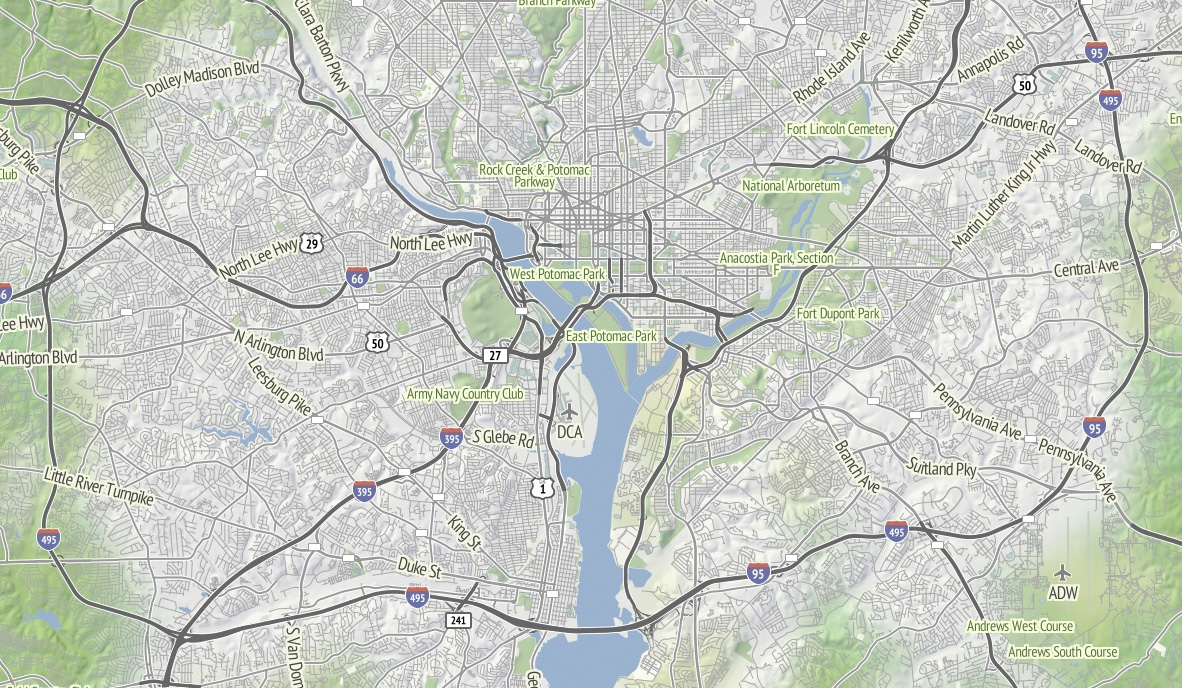
TL;DR: We’re making the terrain map available as a US-only tile layer. It has shaded hills, nice big text, and green where it belongs. The map is made of 100% free and open data, including OpenStreetMap for the foreground and USGS landcover and national elevation for the background. Code here.

Left unchecked, I’d hack at the map indefinitely without launching anything. This week I shaved a few final yaks and now there are U.S. map tiles for you to use, along with an interactive preview. Tile URLs come in the same format as other slippy map tiles, they look like this:
http://tile.stamen.com/terrain/zoom/x/y.jpg
You can add a subdomain to the beginning to help pipeline concurrent browser requests, e.g. a.tile.stamen.com, b.tile.stamen.com, up to d.
The source for everything is on Github, but it’s in a messy, half-described state which Nelson Minar is helping triage and disentangle.
Notable Yaks
The street labels and route shields for this map probably accounted for the majority of the time spent. I’m using a combination of Skeletron and route relations to add useful-looking highway shields and generate single labels for long, major streets. One particular OpenStreetMap contributor, Nathan Edgars II, deserves special mention here. I feel as though every time I did any amount of research on correct representation or data for U.S. highways, NE2’s name would come up both in OSM and Wikipedia. He appears to be responsible for the majority of painstakingly organized highways on the map. Thanks, Nathan!
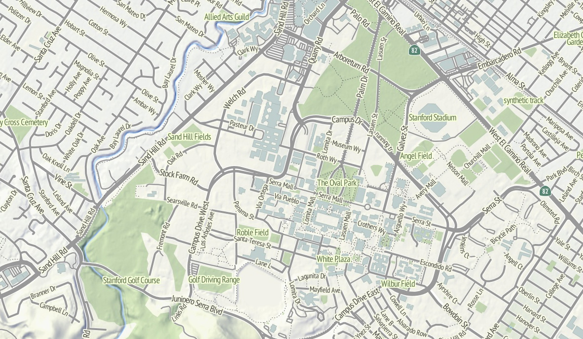
Skeletron also helped handle the dual carriageways, a common peculiarity of geographic street data where the individual sides of divided roadways are in the database as separate one-way lines, visible in the image of Stanford above. It can make for some pretty frustrating renders (the “MarketMarket DoloresDolores GuerreroGuerrero” problem I’ve mentioned before) so I’m literally processing every major street in the continental United States at a range of four different zoom levels to do the merging. There’s a great big code repo showing how it works; skeletron-roads.sh is the important part; I’ll get some shapefiles posted someplace useful in the near future.
I’ve done a bit of High Road-style work with town names to figure out the range of representations in OpenStreetMap, and I think I’ve figured out a scheme for about zoom 12 and above that allows major cities to show at high priority and not flood the map with a layer of useless GNIS “hamlets” like Peralta Villa. It still looks wrong to me in places, but it’s a lot better than OSM’s omission of Boston in favor of Cambridge until zoom 10.
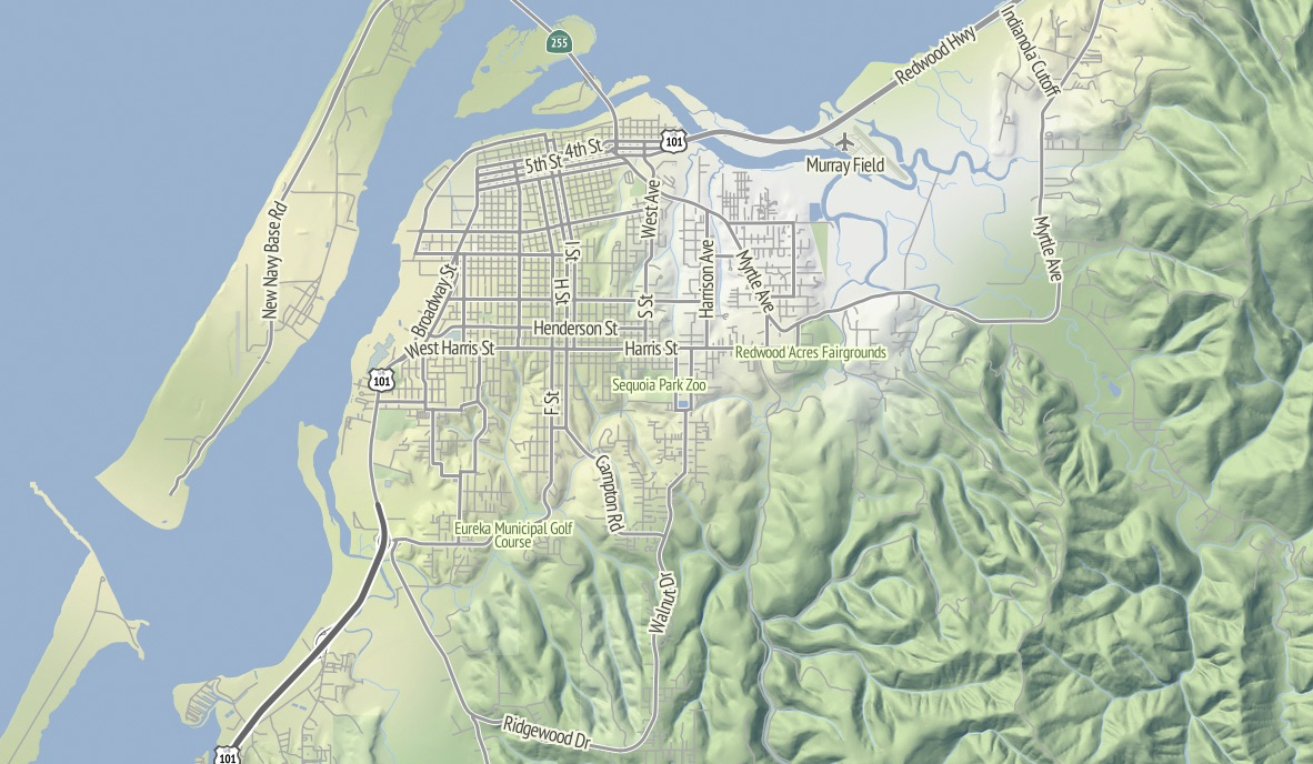
I’m thinking that Stamen can probably commit to OSM updates about once every month or so, since we’re not Frederick Ramm and have to do them semi-manually. Because this map style makes such an explicit and noticeable difference between major and minor roads, I’m expecting many resulting changes to be road classification edits. For example, Nathaniel reclassified a bunch of streets in his hometown of Eureka from residential to tertiary or secondary to reflect the major routes around town, and now they are labeled more usefully at lower zooms.
Pretty Pictures
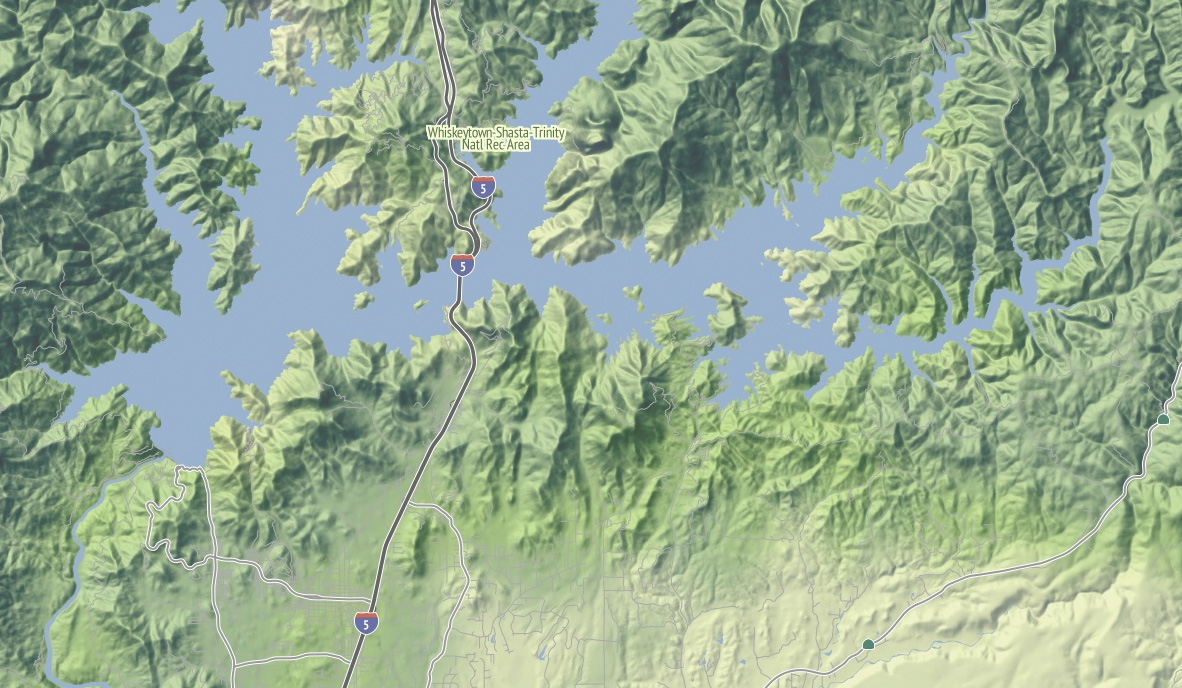
I love this image of Lake Shasta, with the sharply-rising hills around the land and Interstate 5 loping through. This is the northern end of the Central Valley, and the landscape here rapidly shifts to larger, more complex hills as you move north.

Madison, Wisconsin sits between two lakes, and there is a small plaque on the southwestern side of the state capitol building showing how deep under ice you’d be at the same spot 15,000 years ago. I like how the regular grid of the town adapts itself to that narrow spit of land between the two lakes, which I’m told are good for ice fishing and driving during the winter. Thanks to NACIS, I spent a fun few days here in October.
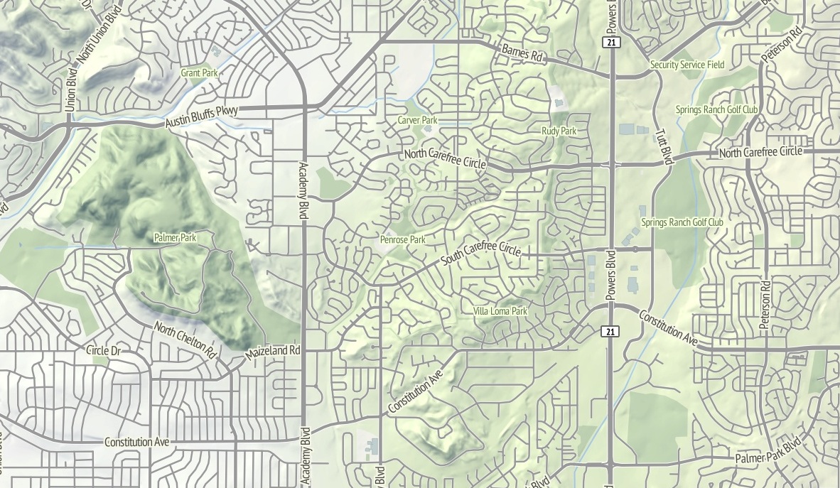
The interaction between the suburban cul-de-sac development and the foothills in this part of northeast Colorado Springs renders well with the warm sunlight on the northwest slope. I’d be curious to know of there’s a difference in property prices here, maybe between the southern exposures to the right and the northern exposures to the left?
I continue to be fascinated by the topography of the Appalachians. Birmingham has this incredible swirl-hill to its immediate southeast, and I wonder if any of these large-scale structures are obvious at ground level when you’re among them?
subscribe to ![]() this site.
|
contact Michal Migurski
this site.
|
contact Michal Migurski