tecznotes
Michal Migurski's notebook, listening post, and soapbox. Subscribe to ![]() this blog.
Check out the rest of my site as well.
this blog.
Check out the rest of my site as well.
Oct 17, 2018 4:00pm
Micromobility Data Policies: A Survey of City Needs
I’ve been writing at Medium.com for the past year. Read this full original post there.
In the past year, cities have been prompted to rapidly re-examine the management and regulation of transportation services due to the influx of micromobility. This recent movement has illuminated major opportunities to expand transportation options while highlighting several challenges for widespread adoption and support. In the context of data, the conversation has evolved quite differently from TNCs just a few years ago. Cities are creating detailed data requirements for operators and are successfully obtaining that information as an input for smarter future transportation plans.
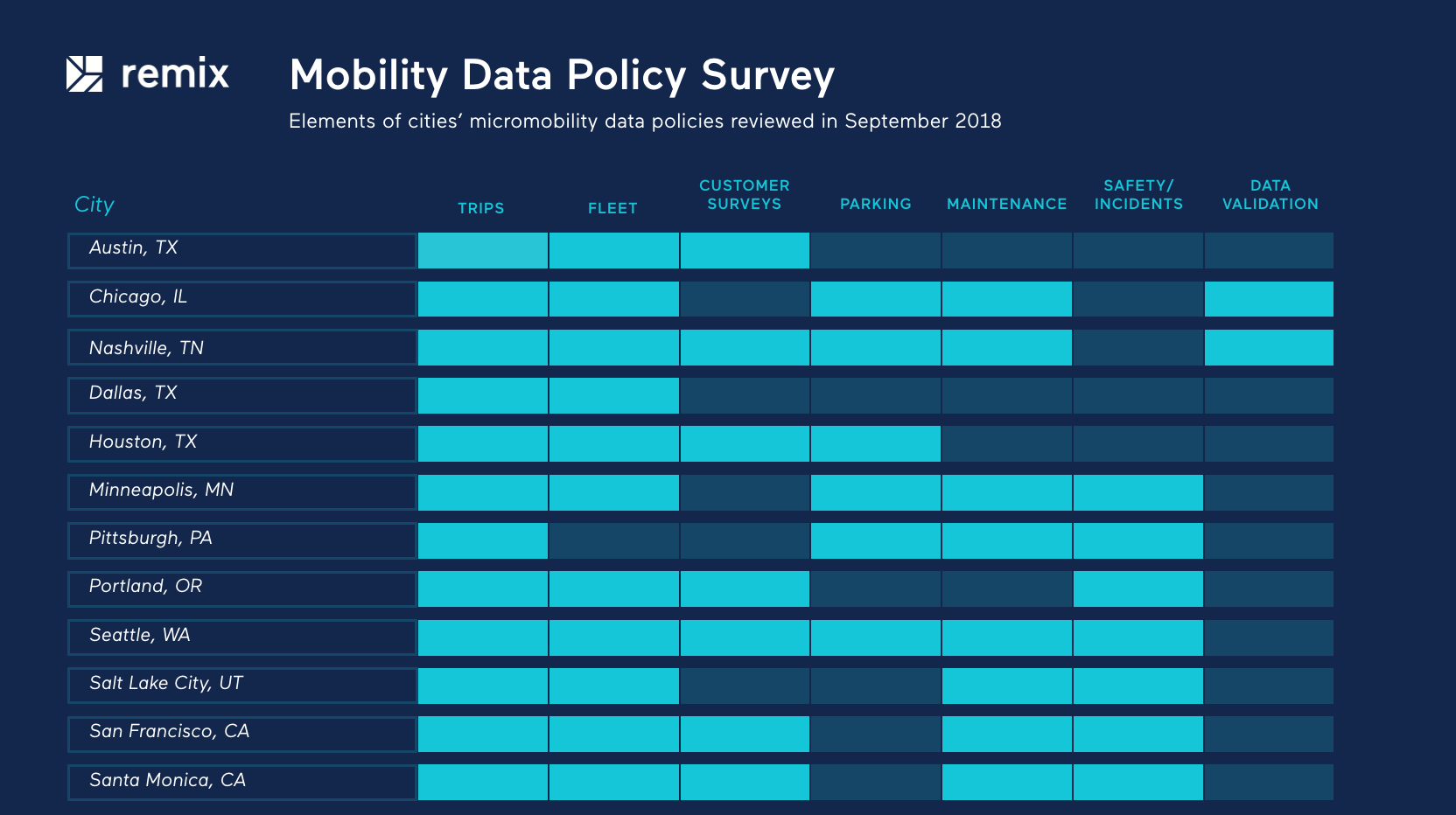
We surveyed over a dozen emerging micromobility data sharing policies in places like Nashville, Chicago, Seattle, Portland, Santa Monica, Dallas, San Francisco, Austin, Denver, Pittsburgh, Houston, Durham, Salt Lake City, and Chattanooga. These policies represent a combination of exploratory pilot programs, post-pilot permits, and even one emergency rule. Based on our research, we see these core data sharing policy features:
subscribe to ![]() this site.
|
contact Michal Migurski
this site.
|
contact Michal Migurski
Comments
Sorry, no new comments on old posts.