tecznotes
Michal Migurski's notebook, listening post, and soapbox. Subscribe to ![]() this blog.
Check out the rest of my site as well.
this blog.
Check out the rest of my site as well.
Feb 8, 2010 8:34am
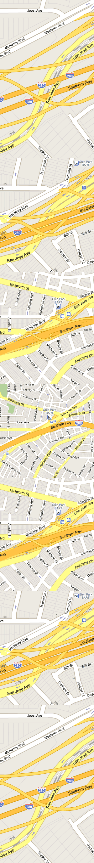
zoom transitions
There's something really nice going on in this series of zooms around San Jose Ave and 280. I like the introduction of layering as the details move into focus:
subscribe to ![]() this site.
|
contact Michal Migurski
this site.
|
contact Michal Migurski
Comments (2)
Related: I've always considered interesting the idea of using the zoom event on a embedded map widget to alter the webpage around it, thus using the zoom control to alter both subject and context. I'm probably been unintelligible here. I mean for example, if you have the canonical GMaps widget on a webpage, and you zoom in, capturing the zoom event on the widget and changing both the map *and* the page contents, so the content reflects how local/global your interests are (i.e., roughly mapping zoom to scope of interest) Of course, subtler applications of the general idea could/should be pursued. I've been thinking about that for a long time, but I don't remember seeing any example. Glad I let it off my system, although I sincerely doubt I've communicated well what I mean. My english seems specially fuzzy today :D
Posted by mort on Friday, February 12 2010 4:57pm UTC
There is also some great nighttime streetview camera glitches going on on the north side of San Jose avenue right around the 1406 on the map. Interestingly beautiful stuff and probably made it past the edit stage only because the southside of of the street is captured properly in daylight.
Posted by Abe on Friday, February 19 2010 11:19pm UTC
Sorry, no new comments on old posts.