tecznotes
Michal Migurski's notebook, listening post, and soapbox. Subscribe to ![]() this blog.
Check out the rest of my site as well.
this blog.
Check out the rest of my site as well.
Mar 3, 2008 8:09am
oakland crime maps X: return of the jedi
We launched Oakland Crimespotting back in August, and all was well for a short time. There were friendly mails from Pete Wevurski, John Russo, and others who liked what we were up to. Unfortunately, we ran afoul of Oakland's website availability, and by late October it became completely impossible for us to collect data at a sustainable rate. We closed up shop and replaced the front page of the site with an apology and a promise.
After several months of general stagnation, Oakland City IT reconnected us to a current, reliable, and accessible data source in January, and I can now confirm that it all Just Works.

There are a few bits of New sprinkled throughout the site.
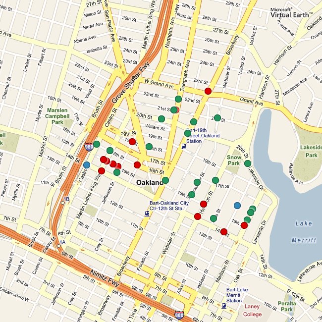
We've added pages for individual police beats, such as this one for 04X, where I live. A large number of our users asked for these, though truthfully it wasn't something I expected. I've been historically critical of the forms-first approach that CrimeView Community takes ("Easy wizard interface"), eschewing it in favor of a maps-first approach. Changing standards of cheapness are a recent interest of mine, and it's cheaper to show everything. Expect to hear more of this from Tom at E-Tech tomorrow. In fact, Police Service Area and City Council District aren't ways that Oakland residents commonly locate themselves. The Police department is organized into beats, and this turns out to be the right way to interface with them if you're a concerned, active citizen. Each beat has a consistent set of officers and public contact information. Oakland CTO Bob Glaze told me the beat designations haven't changed in decades. Clearly, maps and data for individual beats were going to be necessary.
Each beat page features a map of recent reports in that area. These maps are the result of Aaron's heroic work in extending Modest Maps' static mapping abilities. WS-compose is now a sweet little map generator that will happily report geographic dot locations in HTTP response headers if you ask it nicely, among other tricks.
There are also per-beat news feeds and downloadable spreadsheets of detailed information for neighborhood crime prevention councils.
The other addition is a proper comment feature. In the past, we've had an error report form on each crime report page where residents could alert us to improperly-placed reports or other mistakes, but this wasn't as effective as it could have been. The primary problem was that posting an error report didn't really set off any alarm bells, and it certainly didn't appear on the site anywhere. I've grown to feel that replacing a clunky web interface with a mute one isn't necessarily much of an improvement, so it's valuable to provide a direct feedback mechanism right there on the site.
The error reports have now been replaced by actual comment forms where you can leave your name, a message, and an optional link at the bottom of each individual report page. The comments are keyed on the case number, so case numbers with multiple reports share a set of comments. Right now these just look like regular blog comments, but the intent of the link is to add news articles or connect reports to one another. I hope very much to see this feature of the site grow into something interesting and unexpected.
Here is the mail I sent last month announcing our return:
Hello Everyone,
We're happy to announce that Oakland Crimespotting is back, thanks to the generous help of Oakland's City Information Technology Department. After three months without access to report data, we've been granted a reliable, regularly-updated source of crime report information. This is great news: it means that the website is back up and running with current information, e-mail alerts and RSS feeds work again, and we at Stamen Design can explore new ways of presenting and publishing this important information.
Here are a few things you can do, now:
Visit the site at http://oakland.crimespotting.org/. View a map at http://oakland.crimespotting.org/map/. Sign up for alerts at http://oakland.crimespotting.org/alerts.
We are also interested in what additions to the site you would find useful or interesting. So far, we've had a number of suggestions that we're actively looking into: spreadsheet-friendly downloads, details on individual police beats, a search function, and more than one month's worth of data. If you have any thoughts on these or other ideas, send us a mail at info@crimespotting.org.
Our return would not have been possible without the help of a few key people. Ahsan Baig, Ken Gordon, and Bob Glaze at Oakland City IT built and published a source of information for us. Ted Shelton, Charles Waltner, and others helped us navigate the difficult waters of City Hall communications. Jason Schultz, Ryan Wong, Karla Ruiz, and Jeremy Brown at U.C. Berkeley Law School helped us understand how to best approach city governments for information. Kathleen Kirkwood and Pete Wevurski at The Oakland Tribune helped us understand the journalistic context of the project. Dan O'Neil and Adrian Holovaty at EveryBlock.com were a valuable sounding boards for ideas
subscribe to ![]() this site.
|
contact Michal Migurski
this site.
|
contact Michal Migurski