tecznotes
Michal Migurski's notebook, listening post, and soapbox. Subscribe to ![]() this blog.
Check out the rest of my site as well.
this blog.
Check out the rest of my site as well.
Jul 15, 2006 8:16pm
unbuilding
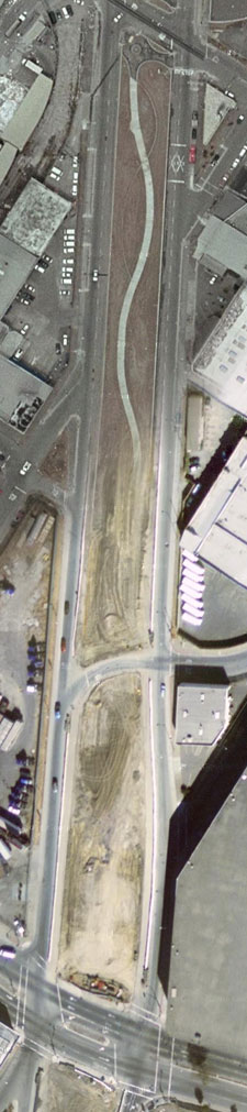
Oakland's Mandela Parkway, seen in Google Maps. This is the former site of the Nimitz freeway, a raised double-decker road that collapsed in the 1989 Loma Prieta earthquake. At 24th street, the boundary between two satellite image sources simultaneously shows the park during construction and after construction (run-up title for this post: Schrodinger's Park). Hopefully, a hint of things to come if Google opens up layers of historical satellite images in Maps.
subscribe to ![]() this site.
|
contact Michal Migurski
this site.
|
contact Michal Migurski
Comments
Sorry, no new comments on old posts.