tecznotes
Michal Migurski's notebook, listening post, and soapbox. Subscribe to ![]() this blog.
Check out the rest of my site as well.
this blog.
Check out the rest of my site as well.
Jul 21, 2006 5:26pm
blast from my past
Just saw this now:
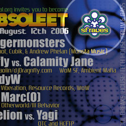
I made that logo a little over ten years ago, shortly after subscribing to SFRaves with my first UC Berkeley e-mail account. It existed in a few variations, starting as a series of laminate designs for finding other list members at parties, to a run of 30 T-shirts I hand-screened for a July 1996 FnF event.
For a college freshman, SFR was an insanely great way to discover the richness of San Francisco and the east bay. It was like a private tour of the undersides and hidden structures of the area, visited and reimagined for eight hour stretches every weekend. Beaches, warehouses, new office spaces, former office spaces, dance studios, and roller rinks were all fair game. The dot-com surge of the late 90's brought this to a head, increasing the number of partygoer hopefuls while simultaneously taking favorite spots out of play. The cultural and economic shifts that made the SFLNC necessary eventually doomed the vitality and energy of raving into just another industry. Now that I've lived here long enough to have a longer view of the area and a basic understanding of how all the streets fit together, underground events provide less revelatory context than they once did. The only solution I can think of is to move someplace new and learn a new street grid, or carve out whatever piece of my frontal lobes is responsible for spatial reasoning so I get to rediscover everything all over again.
I haven't been subscribed to SFR for a long time now, but I still enjoy seeing stuff like this surface from time to time.
subscribe to ![]() this site.
|
contact Michal Migurski
this site.
|
contact Michal Migurski
Comments
Sorry, no new comments on old posts.