tecznotes
Michal Migurski's notebook, listening post, and soapbox. Subscribe to ![]() this blog.
Check out the rest of my site as well.
this blog.
Check out the rest of my site as well.
Sep 20, 2005 4:02pm
72hours tagged navigation
I'm putting together some emergency kits for when the big earthquake hits and FEMA takes a week to get north of Fremont. I noticed that San Francisco's 72 Hours site has a really interesting tagged navigation concept.
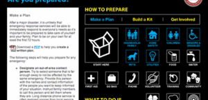
The site plan is broken up along two major axes: task-centered overviews across the top (Make a Plan, Build a Kit), and topic-centered details below. Each task page (shown here) is tagged with the topics it touches, for example Build a Kit highlights the Pets, Food, Water, First Aid and others. This gives a helpful, quick point of entry into the first-level goals that need to be accomplished and uses active verbs to do so.
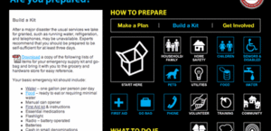
These quick entry points are augmented by details within each topic page, which provide extra information not covered by the quick-start pages.
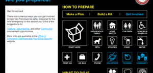
The whole sites uses guessable, crawlable URL's, e.g. "pets.html". There's no side navigation bar, and it's beautifully focused on the goal. Even site name serves as a helpful reminder of the amount of time you should be prepared to live on your own, and frames all the advice within.
subscribe to ![]() this site.
|
contact Michal Migurski
this site.
|
contact Michal Migurski
Comments
Sorry, no new comments on old posts.