tecznotes
Michal Migurski's notebook, listening post, and soapbox. Subscribe to ![]() this blog.
Check out the rest of my site as well.
this blog.
Check out the rest of my site as well.
Jun 30, 2008 12:57am
the map is here for you to use
Suddenly I care about OpenStreetMap, all over again.
OSM is a cognitive surplus project whose ultimate goal is a CC-licensed, crowd-sourced vector map of the world, competitive with Google, NavTeq, TeleAtlas and other geographic data providers. The project has been in motion for the past four years, with especially active support in Germany and the UK and a recent TIGER/Line infusion for the United States.
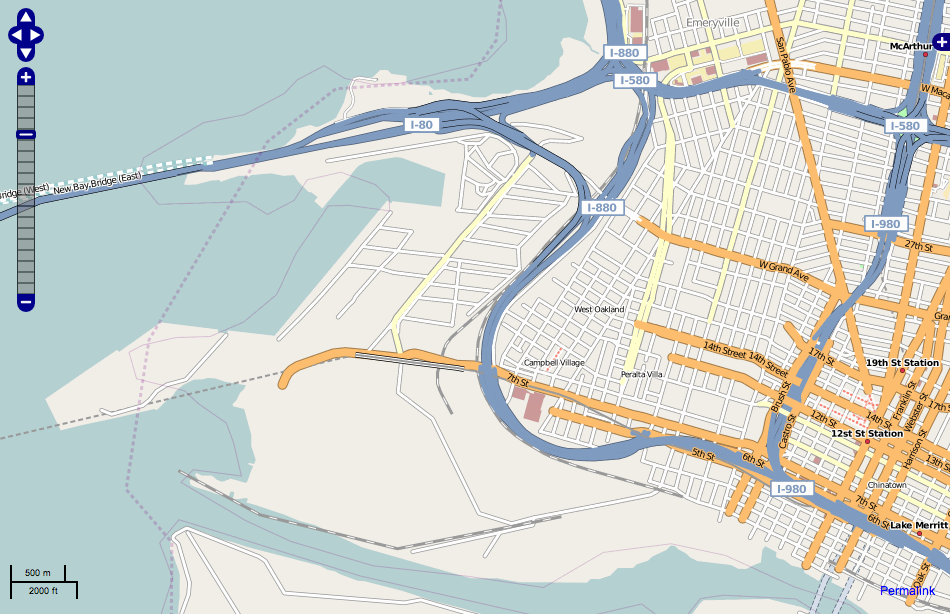
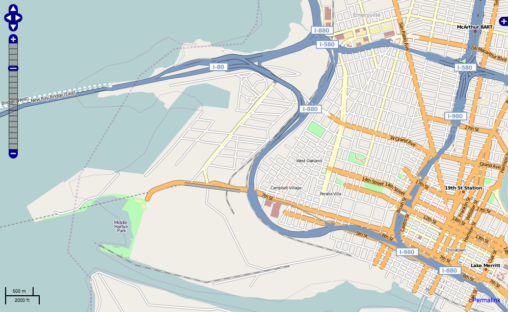
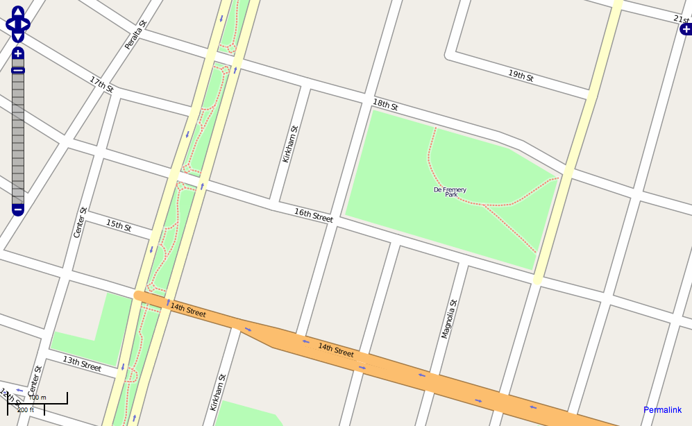
Why is OSM interesting? Having watched Oakland transition from the raw TIGER/Line data import to a more refined, watched-over state (compare the visual appearance of nearby Concord to West Oakland for a sense of the difference), I'm starting to think that the main advantage of OSM might be in the kinds of details overlooked by the larger mapping agencies, and in a certain unevenness of coverage indicating which places are cared-for. Over the past few weeks, I've spent a few hours drawing in parks near where I live:
(before)
(after)
The difference isn't exactly earth shaking, but it does begin to introduce a feeling of reality into the rendered image. Raw streets are probably accurate enough for basic driving purposes. Parks fill in details, and promise that what you're seeing bears some relationship to what you'll find if you were to actually visit.
Google Maps' coverage of West Oakland is still substantially wrong, especially outside the 880 loop in the Port Of Oakland territory. They've still got Army Base roads that no longer exist, and miss Middle Harbor Shoreline Park completely. Small potatoes until you think about the effort expended to convert port and military territory to more civic uses in a part of town known more for its asthma-aggravating emissions than its amenities.

The potential for detail represented by OSM extends down into territories more conventionally associated with local-type business listings. Tagging your input with "amenity: pub" causes a little amber pint glass to be rendered to the main map, betraying the beer preference of OSM's British founders and their aims for a richer mapping experience:

What's really going on here is that a particular historical wall is being chipped away. The understanding fostered by the Googles and NavTeqs of the world is that map data is an unchanging (or at least unchangeable) base layer, with transient information such as directions or grocery stores layered over it. What's interesting about OSM is the edit button, the thing where you get to apply your own local knowledge about your area for others to benefit from. This is where I think OSM is finding its niche as a credible alternative for those who need maps. For example, we decided to go with a Virtual Earth base layer for our Oakland Crimespotting project, to expedite its launch at a busy time. Almost a year later, we may suddenly find that OSM's data for Oakland has reached sufficient quality for use in a real application, one where we might (for example) choose to mark and render liquor stores, schools, or police stations right on the map layer for added crime data context. We don't need nationwide coverage, but we do need excellent local coverage and are probably willing to do the footwork to improve an area for our own immediate benefit.
The kind of custom rendering implied by what I'm describing is starting to become a sane possibility, with software like Mapnik making available high quality visual rendering of geographic information. Paul Smith of EveryBlock described its basic use in an ALA article a few months back, while we've been using the software to a point where we can confidently predict its blackbox behavior and really start to customize its output.
Annoyingly, OSM is still finding its technical footing. Despite an excellent API, changes made to the underlying data take a few days to appear in the officially rendered tile sets, and the editing tools are still a bit dorky for general consumption. This may not ultimately matter as far as the basic idea is concerned - momentum behind the project is sufficient for it to gain a foothold in certain key metropolitan areas, and supports specialist efforts like derived cycling or topographical maps. I can imagine other specialist needs like motocross, fishing, bed and breakfasts, etc. taking over the care and feeding of certain kinds of map data. It's easy to forget that familiar road maps were once a hobbyist endeavor as well.
I'm interested in a near future where the native advantage of commercial mapping agencies becomes a liability. Might there be a situation where it's no longer economically feasible for company representatives to drive every street when there might be equally-good input from crowds of motivated participants? At some point, the quality of the basic street grid becomes Good Enough, and the kinds of details noticed only by locals takes on greater importance.
subscribe to ![]() this site.
|
contact Michal Migurski
this site.
|
contact Michal Migurski
Comments
Sorry, no new comments on old posts.