tecznotes
Michal Migurski's notebook, listening post, and soapbox. Subscribe to ![]() this blog.
Check out the rest of my site as well.
this blog.
Check out the rest of my site as well.
Jan 18, 2010 8:33am
last week: new york
I had kind of a bonkers trip to New York this past week. My proximate reason for being there was an invitation to Microsoft Research's annual Social Computing Symposium (SCS), an invitational held this year at NYU's ITP program. Another reason was to visit the U.S. Geological Survey's Volunteered Geographic Information workshop. A third was to pay visits to a bunch of east coast superheroes. The thing I love most about these whirlwind adventures is that you have an excuse to compress a full schedule of visiting into a very short span of time. I had a chance to meet and reconnect with a few people I like and respect quite a bit. I felt warmly embraced.
The SCS theme this year was "City As Platform", and the structure of the event was brief talks punctuated by puppet shows. About half the people gave presentations, though I wasn't one of them because I was thinking more about the USGS thing for later in the week (more on that below). Steven Johnson gave an opening talk that made me think I had accidentally bumbled into a TED or Davos, though the situation did rapidly improve.
Kevin Slavin gave my favorite kind of talk, a barnstormer that I found simultaneously fascinating and provided a lot of hooks for debate. Liz Goodman took better notes than I, and the basic gist was like this:
- Concealment technologies, like the radar-defeating B2 Bomber, work by breaking up a shape rather than hiding it entirely.
- High frequency, algorithmic trades work the same way, tearing larger financial movements down into microscopic dust.
- This modern computerized finance stands in contrast to people-driven, proximity-reliant trading off the past that gave rise to today's financial district.
- Physical proximity required for algorithmic trading is no longer a result of human distance but of microsecond ping times necessary to exploit fast, small differences in price.
- Why can't the whole thing just float off and go away if it doesn't need people anymore?
Kevin connected to the city theme with 60 Hudson as a pivot. It's a massive telecommunications node, and physical distances along the network from this building translate to communication delays, which subsequently translate to money lost or money gained. We used to think about time in terms of distance ("The furlong was the distance a team of oxen could plough without resting"), which we've mostly forgotten since communications speeds got so fast, but the high rents directly around this building show that on some scales, velocity of communication can still be measured.
Now I don't quite agree with Kevin's conclusion. Where he sees an inhuman system that's begging to be pushed off into space where it will cease to bother its once creators, I'm looking at a natural consequence of technological speed in the service of technology. Someone's always going to want to exploit the seams with science. What we need is not to set the thing adrift off-world but to tame it with a new Glass-Steagal. Still, the core humanism of where he goes with this is touching, beautiful and deserving of some attention. Most "city as platform" talk comes in two varieties: information technology and space syntax. There was plenty of both on offer at ITP, lightly brushing the testicular, amoral war-metaphoring that views urban fabric and shared space as just scenery to play out control scenarios. I don't want to call out anything in particular, so I'll just link to an unfortunate recent BLDGBLOG post about Die Hard and the IDF walking through walls after reading Deleuze and Guattari. One of the commenters, Jim Meredith, has this response:
"However, as you note early in you piece by quoting those who maintain, live in, and trust the concept of private space, the Nakatomi/Nablus/DieHard concept is, in fact, a shocking and gross violation of a core concept of civil society."
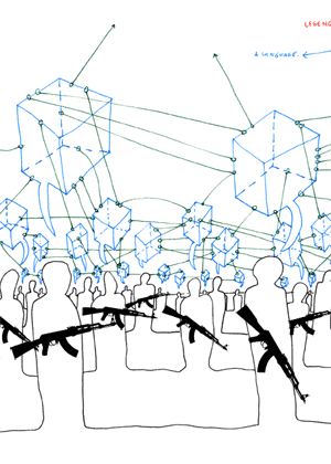
(apologies to Marc Ngui)
Not everyone views the city as a battle suit or a maze of twisty passages all alike, and it's worth thinking about provided functions (sewage, macadamizing) in terms of what they do, who they do it for, and for what price. Anil Dash in particular described his Expert Labs concept, a project to consider and modify the motivations for geek work and the federal government. Did you know that you can't, technically, "give" things to the U.S. government? It's true and Anil's trying to change that. Which is an interesting segue to the USGS event in DC, a workshop intended to explore successful volunteer geographic data programs (like OpenStreetMap) to see how that can be applied to the forthcoming update to the National Map.
Thanks to a door malfunction on my NYC/DC flight, I arrived late to the party and unwittingly delivered a closing keynote. The full content of the talk and my slides immediately follow these other exciting things that happened:
- I visited the New York Public Library map people twice and was allowed to flip through a 17th century Dutch naval atlas.
- I got to meet the amazing New York Times graphics department, including Matt Ericson, Matthew Bloch, Amanda Cox, Shan Carter, and others. These are the people turning our ideas about interaction and mapping online utterly upside-down.
- Grand Central Oyster Bar.
- Veselka for 2:00am pierogi.
- Mark Hansen's genius installation at the NYT lobby.
- Poking my head into the Saturday Night Live studio during filming of Laser Cats.
- Played the new(ish) Mario Brothers Wii game and discovered that my muscle memory of the old game's standard controls has remained fully intact for 20 years despite no external reinforcement.
Now, my slides for the USGS thing.
Readiness.
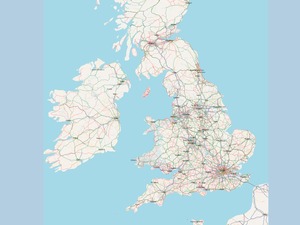
For many years, OpenStreetMap was understood to be a project about the future, meant for productive use someday but clearly unready. Potential users still had to be convinced, and we passed over OSM as a data source for projects in favor of commercial data on a number of occasions. This phase lasted from 2004 to about 2008 for us at Stamen.
In 2008, it started to look more done than not-done.
The social structure and set of motivations that OSM thrives under can be seen as part of the broader trend towards shared development practices and better communication enabled by the open internet. We're seeing a trend toward a larger number of smaller operations unified by an ethos of participation and local scale, something that Brian Marick has jokingly summarized as "artisinal retro-futurism" and "team-scale anarcho-syndicalism". I love this description.
In our work, we're generally on the receiving end of map data, and I've got some examples showing cartography I particularly enjoy that's benefited from OSM as a resource.
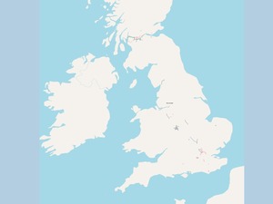
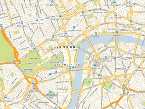
Stamen's "Fresh" map style for Cloudmade, showing legible web cartography for inner London, was immediately applicable to the rest of the world upon launch. It's used by OffMaps, Noticings, and others as a default, web-native basic road map without some of the distracting recognizeability of Google Maps.
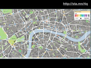
UK designer Matt Jones of BERG used Cloudmade's style editor product to apply Kevin Lynch's ideas about the city as a network of paths, edges, districts, nodes, and landmarks for heavy traveler social network Dopplr. Particular ideas about the role of information on the map can be rapidly experimented with and published to a broad audience.
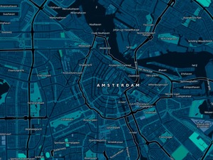
Stamen also did the Cloudmade Midnight Commander map style, answering a creative brief suggesting a design appropriate to Jason Bourne's in-car GPS. Again, something that starts as a small idea or even a joke can very quickly go into full production when simple, well-understood data is available.
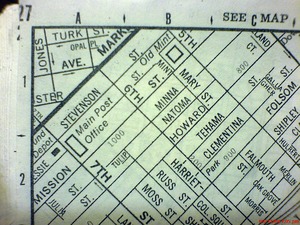
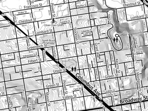
I've also been exploring the adaptation of paper maps like this 1996 Rand McNally SF street atlas popular among bike messengers. The result has been OSM-derived, print-ready cartography that additionally incorporates civic parcel and contour data.
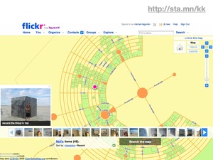
Finally, Yahoo photo-sharing web service Flickr has used specific portions of OpenStreetMap data in places where Yahoo Maps has poor or non-existent coverage. The transient desert city of Burning Man is one such example, surveyed and laid-out fresh each year. OSM Foundation board member Mikel Maron contributes his mapping expertise to the Burning Man Earth project to provide visual context for the thousands of photogrpahs that come from the art festival each year.
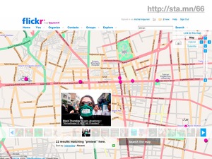
When anti-government protests broke out in Iran last year, Flickr was able to rapidly pull in high-quality maps of Tehran to provide immediate geographic context to the sudden flood of news and imagery. I'm told that high quality road data for cities like Tehran is traditionally quite hard to come by via normal channels, since there's very little road navigation market for western companies there.
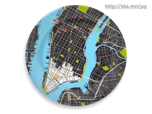
Services such as Google's and the iPhone are bringing more different kinds of people in close contact with cartographic design through their daily lives than ever before. We know that use and familiarity breeds discerning taste, and cartography has become popular, decorative, desirable, and functional.
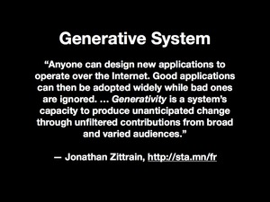
What specific technical characteristics of OpenStreeMap motivate the creation of this broadly useful data set? I think that a few critical decisions made in the early days of the project have endowed it with generative properties, the "capacity to produce unanticipated change through unfiltered contributions from broad and varied audiences" as Jonathan Zittrain has said.
Three specific features of OpenStreetMap have this effect.
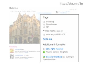
First, each object in the system has a unique and durable identifier. Objects basically stay put, and are composed of very simple primitives. There are no curvy lines in OSM. The identity of each object in the OpenStreetMap database is exposed to the outside world, so that Flickr can let you refer to specific OSM features in your photography. Here we have a photograph of the Queen's Chambers in Manchester that's explicitly connected to the building footprint in OSM because the two entities can be tagged together. The system is useful even when not explicitly mapped.
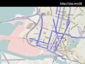
Second, the tagging structure is free-form. You can apply your own arbitrary descriptions to features, generally conforming to the basic expectations of the community with tags like "highway", but often departing from them entirely. Andy Allan created a rendering for his OpenCycleMap project that specifically called out features with tags relevant to bicyclists, like these portions of the bike network in Oakland. New tag conventions are decided through use rather than committee. Most theoretical arguments about the appropriateness of one approach over another are moot until actual use by a number of people over time can be shown.
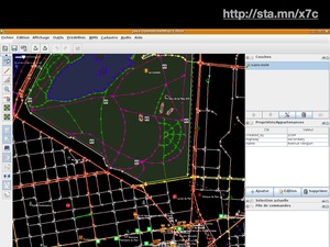
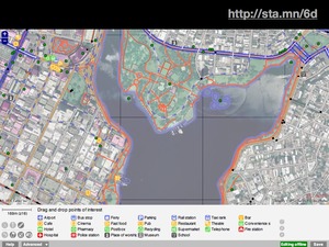
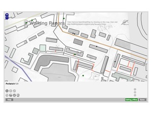
Finally, there is an open API. OSM's core feature is a complete, well-understood way to move data into and out of the service. This has made it possible to create numerous ways of recording and editing OSM data. JOSM is the editor for the precise, obsessive, and German. Potlatch is the web-based editor that lives under the default "edit" tab on the site, and includes simple tools for pulling different kinds of points of interest into the aerial map.
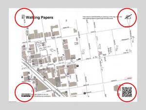
Walking Papers is my own research project, and provides a way for paper data collection to help OSM. Each of these applications takes advantage of OSM's well-documented and simple protocol to moved information through the system, with varying amounts of complexity available to different user populations.
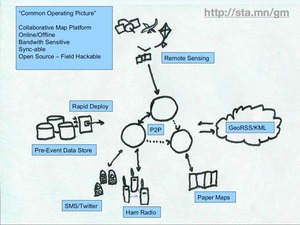
I want to close with this napkin sketch by Mikel Maron. Many years ago, Mikel showed a possible "common operating procedure" around the project, incorporating numerous technologies not normally associated with desktop geography. Much of the methodology drawn here did not yet exist at the time, but Mikel could be sure that with healthy usage patterns it would be possible to draw double heads on each of the arrows with some reasonable expectation of future possibility.

Comments (4)
Bummer that we missed you. We'd love to have you by our office or treat you to lunch next time you are in town. �R
Posted by Rolando Peńate on Wednesday, January 27 2010 8:57pm UTC
Err, "we" being OpenGeo�the folks behind PostGIS, GeoServer, GoeExt, etc.
Posted by Rolando Peńate on Wednesday, January 27 2010 8:59pm UTC
Hi Rolando - I'll get in touch next time I'm out there!
Posted by Michal Migurski on Wednesday, January 27 2010 11:18pm UTC
... lovely. you're living up to your standards again and again. I wonder (and admire) how you get things done so straightforward, Michal.
Posted by Stefan Knecht on Monday, February 8 2010 8:27pm UTC
Sorry, no new comments on old posts.