tecznotes
Michal Migurski's notebook, listening post, and soapbox. Subscribe to ![]() this blog.
Check out the rest of my site as well.
this blog.
Check out the rest of my site as well.
Jan 7, 2013 12:31am
loading artifacts, google maps for iOS
The new GMaps for iOS uses the same/similar vector loading process as its longtime Android counterpart. The high-res stuff, including buildings and tiny streets, looks like it comes in right at zoom level 16, which is about where I would’ve put it given the choice.
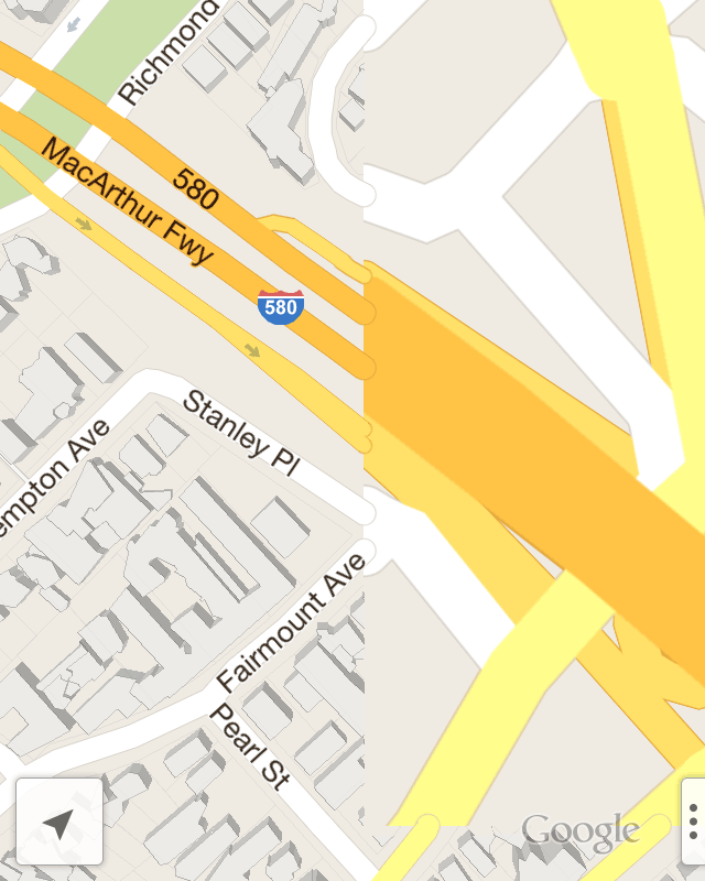

The transition between zooms is a bit odd. I would not have expected the difference in street widths between the loaded and unloaded sections here. OpenGL does how (as far as I know) have its own concepts like round line caps or joins, so maybe there’s some client-side buffering these that’s expensive to run more than once per geometry load? The “hot dog” street endings show that each tile’s worth of geometry data comes clipped; I haven’t tested to see whether street names straddle z16 tile boundaries or not.
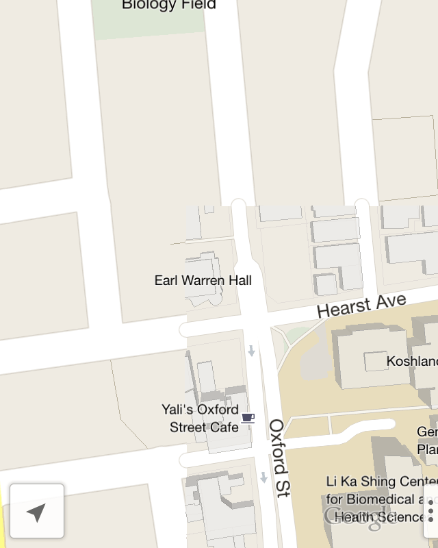

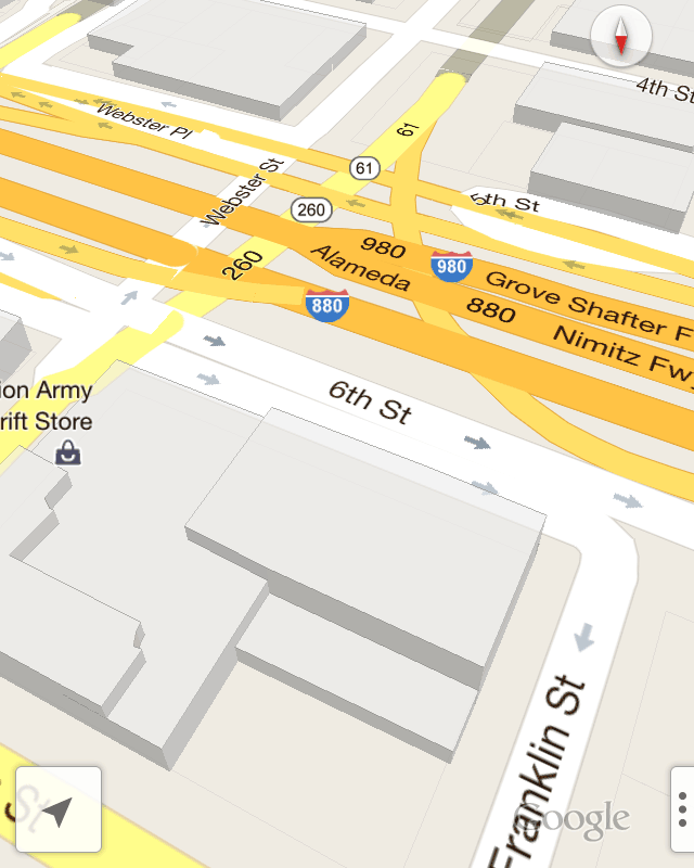
Interestingly, GMaps makes no attempt to model elevated freeways, terrain, or anything else vertical beyond buildings. In use, this feels like a satisfactory compromise. The road names here are in perspective, applied to the ground as textures, while the route numbers are all billboards facing forward.
I’m not sure why the Grand Avenue label below is not tilted back like Elita or Perkins.
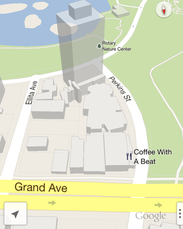
The translucent handling of the building is very good. It’s sketchy enough that you can recognize them and navigate without being distracted by their incompleteness.
subscribe to ![]() this site.
|
contact Michal Migurski
this site.
|
contact Michal Migurski
Comments (1)
If I recall correctly I heard in a google talk about webgl and maps that they were rendering circles to create the roads joins (and endings). I though they were not cutting the geometry but your image points they are.
Posted by javisantana on Friday, January 11 2013 5:41pm UTC
Sorry, no new comments on old posts.