tecznotes
Michal Migurski's notebook, listening post, and soapbox. Subscribe to ![]() this blog.
Check out the rest of my site as well.
this blog.
Check out the rest of my site as well.
Aug 10, 2009 5:05am
dispatch from camp roberts
Mikel has me beat with a series of four posts about our recent adventure to Camp Roberts near Paso Robles in Central California. Sean's also got a great run-down from Google's perspective.
John Crowley of STAR-TIDES (Transportable Infrastructures for Development and Emergency Support) drew on a range of worldwide development talent to participate in a hypothetical Afghanistan disaster scenario, featuring remote location, unpredictable connectivity, limited time, and rapid assembly of geographic data from sources like UAVs and on-the-ground observation. Some of our co-participants included Google with accompanying Fusion Server, InSTEDD and their SMS-based geochat system, DevelopmentSeed's Drupal-based monitoring and coordination software, and my own dog in the fight, Walking Papers. The week served to validate many of the concepts sketched out in Aaron Cope's Papernet, and also helped to make the "paper" arrow in Mikel's own 2007 OSM dream napkin sketch point both ways.

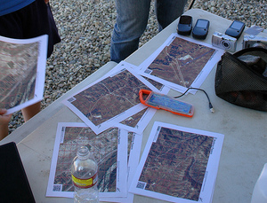
The rough workflow we settled on early in the week had aerial imagery sources at one end and OpenStreetMap at the other. Developer / geographer John Livni adapted Modest Maps ws-compose, an HTTP wrapper for generation of static images from tiled map sources, to use locally-provided inputs, transparent OpenStreetMap overlays, and reference grid lines for easier communication. Interns organized by the Naval Postgraduate School tested interim ideas out in the field.
Mikel Maron brought a local installation of the OpenStreetMap server, with which he was able to quickly supply a source and destination for geodata used in the project.
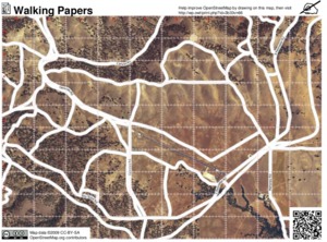
The immediate goal of the project was to provide world-traveler Todd Huffman with a portable Mac Mini installation of Afghan aerial imagery, a modified version of Walking Papers, Sahana, GeoCommons, Geochat, and other just-integrated software for remote experimental use in Nangarhar during the rapidly-approaching 2009 presidential election.
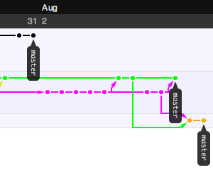
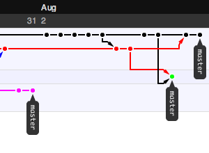
Interestingly, the event setting itself replicated many of the field conditions we might expect in the real world, most importantly a criminally spotty internet connection. This turned into an advantage, partially because we were able to ignore our usual distractions for a period of time, and also because we had made the fortunate choice to use Git earlier. Git was a serious champ here, making it possible to share source code repositories on a local network without losing global context but also without requiring an always-available connection to a central repository. I'm not going to waste too many words on Git advocacy, except to make the point that a good version control system lives and dies by the ecosystem of other tools built around it. I didn't move Stamen over to Subversion until I had seen Trac and all the ways it improved project communication. I also did not consider adopting Git until after I explored Github, the web-based "social coding" site. The killer feature for me was a way to follow others' projects, and graphical network view providing a visual history trail for each repository. Here are some example screen grabs showing views of the Walking Papers "paperwalking" repository from the same point in time, from three forked points of view:

My Git use is still purely experimental, but I'm keeping a close eye on Matt Biddulph's Git links.
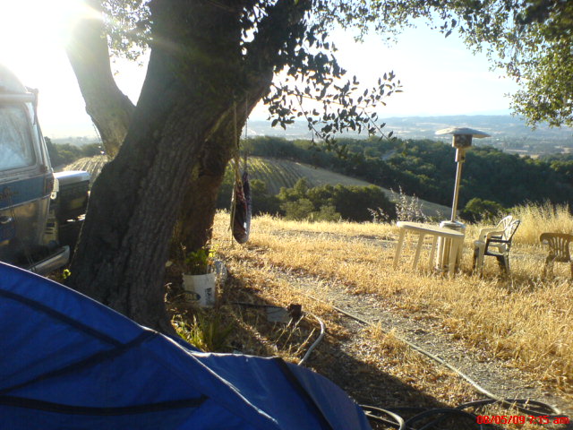
The other half of the week was a lovely camping spot provided by Josh's pal Steve Martell, whose Kaleidos Winery has some of the best rural views and good times I've yet experienced.
It was all a little bit of this...

...and a whole bunch of this.
subscribe to ![]() this site.
|
contact Michal Migurski
this site.
|
contact Michal Migurski